One of the most fascinating sections in Erskine Burnett’s scrapbook album, The Shuswap Country, is the description and photos of his camping trip into the Monashee Mountains in the early 1940s.
His guide was Bill Fraser, who began homesteading at Sugar Lake in approximately 1910 and, after his orchard burned in a forest fire, he and his wife Peggy set up a fishing lodge.
Fraser had first arrived from the east over a pass through the mountains from Nelson via Arrow Lakes and Margie Lake, where, in 1908, he had built a cabin and lived there through the winter.
It was quite the mid-July adventure for the four men and their horses that had to first swim across the river to the trail.
“Bill or Wash led the way, slashing out new growth on the trail with big knives that looked like meat cleavers.”
On the crude bridge across Rainbow Creek, their pack horse Paddy slipped between the logs, spilling the gear and his hat. Fortunately, they recovered their gear downstream and were able to pry open the logs to free Paddy. At Rainbow Lake (now called Spectrum), they quickly built rafts to fish and explore the island and the shoreline.
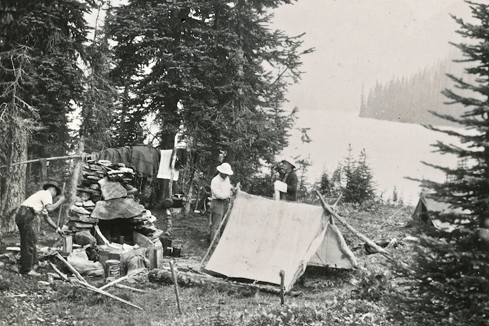
From their base at Peters Lake where they intended to spend two nights, they toured the surrounding area on foot as the horses grazed happily at the lake. Burnett was so impressed with the area, he mused about its potential as a future golf course and tourist resort. On their way to Margie Lake on the first day, they were fortunate to sight caribou, three young yearlings and an old bull.
Amazed at the beauty of the alpine, Burnett also found it a “botanist paradise” as some plants were in seed in the valley but were still flowering at higher elevations. He describes “a tiny glade among the balsam” where “every square foot of space of which was carpeted with a mixture of Indian paintbrush and silvery-green plumes of the anemones” and “the blending of colours and the lighting were perfect.”
Read more: Column - Remembering the famed Lee Creek Harvest Festival
Read more: Column - In search of the Shuswap’s most significant trees
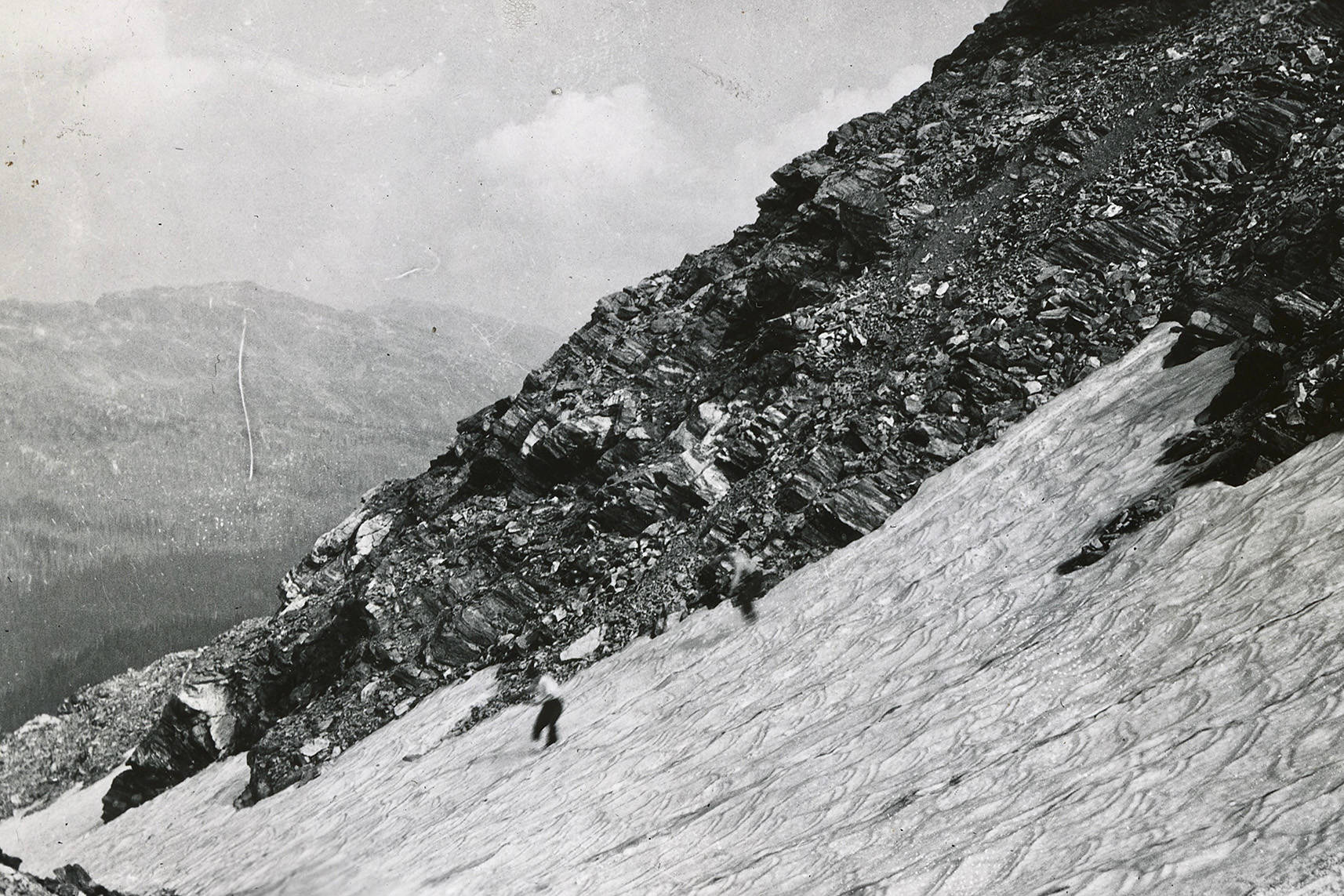
When they attempted to hike up Mt. Fraser on day two, which Bill had named after himself in 1928, they were blocked by a rockslide with a glacier behind it, “which only well-equipped mountaineers would tackle.” They had fun trying out some boot-skiing and when it began to rain, they headed back to camp for another night. The following day they hiked up to scenic Blue Lake and found floating islands of snow in the intense blue water. That night as stories were being told by the fire, they heard a scratching sound behind them and discovered a porcupine chewing a hole in a packsack, which was soon shot with a twenty-two with the help of a flashlight.
The area Burnett explored became Monashee Provincial Park in 1962, in part because of concern over caribou hunting that was decimating the herd.
Many of the names have changed, including the mountain; now Mt. Fosthall that was renamed in the 1950s after an early surveyor.
Peters Lake is now a hiker’s paradise accessed by trails that begin at logging roads either from Sugar Lake or Arrow Lake.
Much of The Shuswap Country includes photos and stories from the Lumby and Cherryville region for good reason, as the nearby mountains offer so much to explore and fortunately Burnett lived close by in Coldstream. On an earlier trip, he joined another Bill Fraser-guided horseback trip up to the Park Mountain lookout, where they met the lookout man who had not seen a visitor in weeks. At 7,000 feet, he was on watch for smoke and when a plume was spotted, he phoned in the location, which was pinpointed thanks to the directions provided by another lookout from a nearby mountain.
The Sugar Lake logging road was under construction then, and Burnett predicted that one day it would follow the trail over the pass below Joss Mountain to the TransCanada highway at Three-Valley Gap, which fortunately never happened. When Bill Fraser first arrived, he found traces of the camp made by geological surveyor George Mercer Dawson, who followed this ancient Indigenous trail in 1878.
Hopefully one day, Burnett’s scrapbook journal could be published so it can be appreciated by many more people, as it provides a captivating and intriguing window into our region’s rich history.
newsroom@saobserver.net
Like us on Facebook and follow us on Twitter