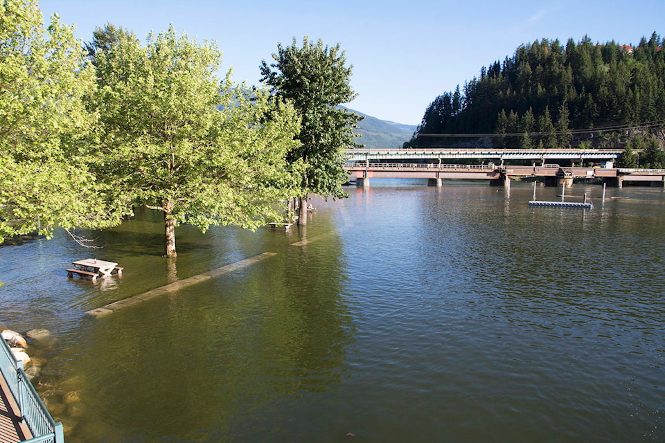
After rising to just over 349 metres above sea level Shuswap Lake is on its way back down.
According to the federal government hydrometric monitoring station which measures the surface level of Shuswap Lake near Salmon Arm, the lake reached a level of 349.12 metres on May 29 and has fallen approximately four centimetres since then.
Shuswaplakewatch.com, a website on which Sicamous resident Bernhard Kramer posts his measurements of the lake level taken at the Sicamous public boat launch, also shows a slight drop after reaching a peak of approximately 349 metres above sea level on May 29.
Related: High water closes parks, boat launches
“The Shuswap Lake level drop will be somewhat slow for a few more days, as large overflow areas, especially along the lower Shuswap River, are now draining back into the main stream. Furthermore, occasional rain showers may also temporarily slow the lake level drop ever so slightly,” The May 30 Shuswap Lake Watch update reads.
Derek Sutherland, the Columbia Shuswap Regional District’s (CSRD) protective services team leader said although many are breathing a big sigh of relief that the lake has started to drop, it is important lake-front property owners keep their guard up.
Related: Canoe Beach closed due to high water
“We’re asking the public in flood prone areas to stay vigilant,” Sutherland said.
“It’s very normal for the lake to peak and drop and then peak again.”
He said significant precipitation could cause the lake to rise once more.
@SalmonArm
sports@saobserver.net
Like us on Facebook and follow us on Twitter